
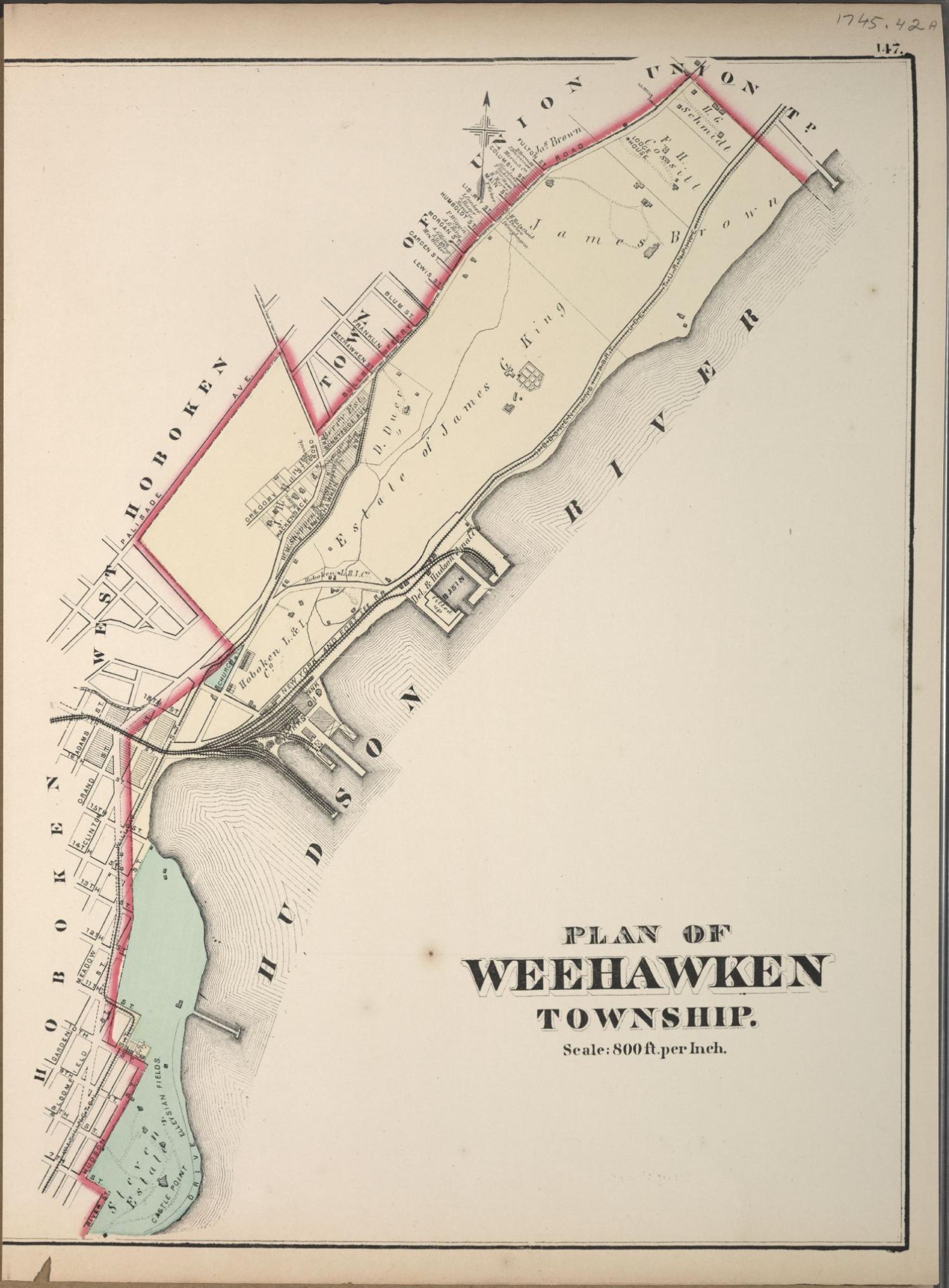
Plan of Weehawken - 1873
Item
- Title
- Plan of Weehawken - 1873
- Description
- Map of the Town of Weehawken in 1873. Map of Hudson County, New Jersey from Actual Surveys Under the Direction of GM Hopkins, CE No. 320 Walnut Street Philadeplhia 2500 feet to the inch Engraved by Edward Busch 1873 Images from the United States Library of Congress (G1258.H7H3) 1745.42A Plan of Weehawken
- Subject
- WHC88103
- Date
- 1873
- Type
- OT
- Identifier
- WHC88103
- Coverage
- Weehawken, NJ [40.7663711,-74.02537149999999]
- Tag
- Maps
- Rights
- This digital image may be used for educational or scholarly purposes without restriction. Commercial and other uses of the item are prohibited without prior written permission from the Weehawken Historical Commission.
Tags
mapPosition: 560 (178 views)