
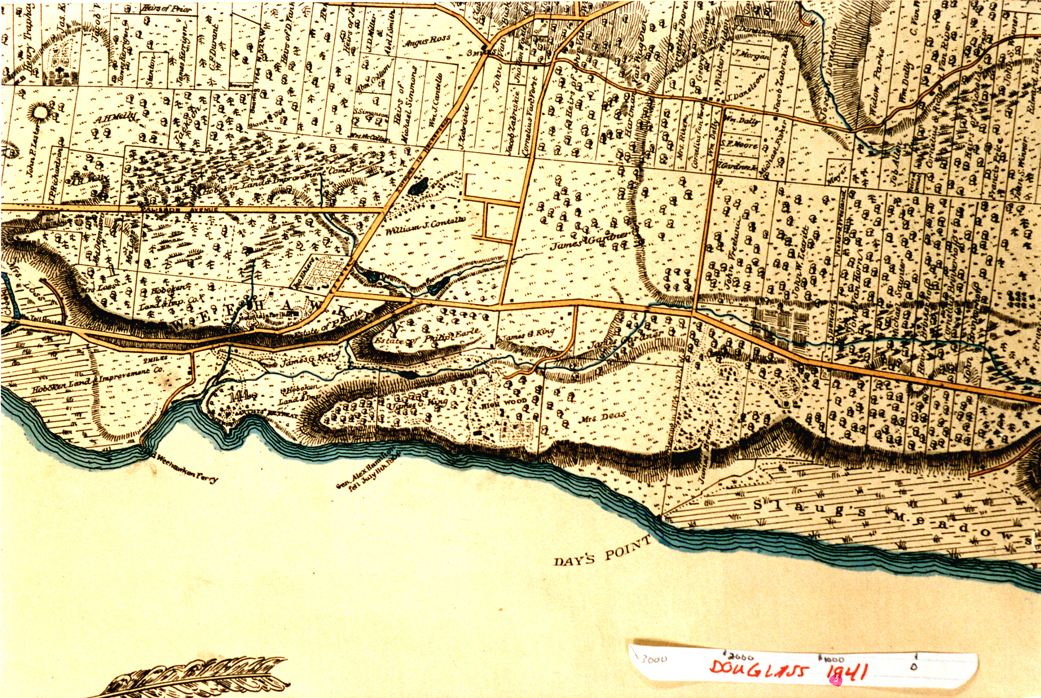
Weehawken Portion of 1841 Map
Item
- Title
- Weehawken Portion of 1841 Map
- Description
- This image shows the Weehawken portion of the Topographical Map of Jersey City, Hoboken and the Adjacent Country Describing Minutely the Courses of Rivers, Brooks, the Township and Original Patent Lines; Railways, Turnpike Carriage & Bridle Roads; the present farm boundaries with the names of their Proprietors, A correct plan of Public Grounds and Gentlemen's Country Seats, the position of Farm Houses, Forests, Swamps and Marshes, showing a complete view of the Face of the Country, from an actual survey by L.F. Douglass, Engineer, Jersey City, 1841. Copied from original in the Jersey Room of the Jersey City Public Library. This image was made and provided by Tom Flagg.
- Subject
- WHC88112
- Date
- 1841
- Type
- OT
- Identifier
- WHC88112
- Coverage
- Weehawken, NJ [40.7663711,-74.02537149999999]
- Tag
- Maps
- Rights
- This digital image may be used for educational or scholarly purposes without restriction. Commercial and other uses of the item are prohibited without prior written permission from the Weehawken Historical Commission.
Tags
mapPosition: 1097 (111 views)