
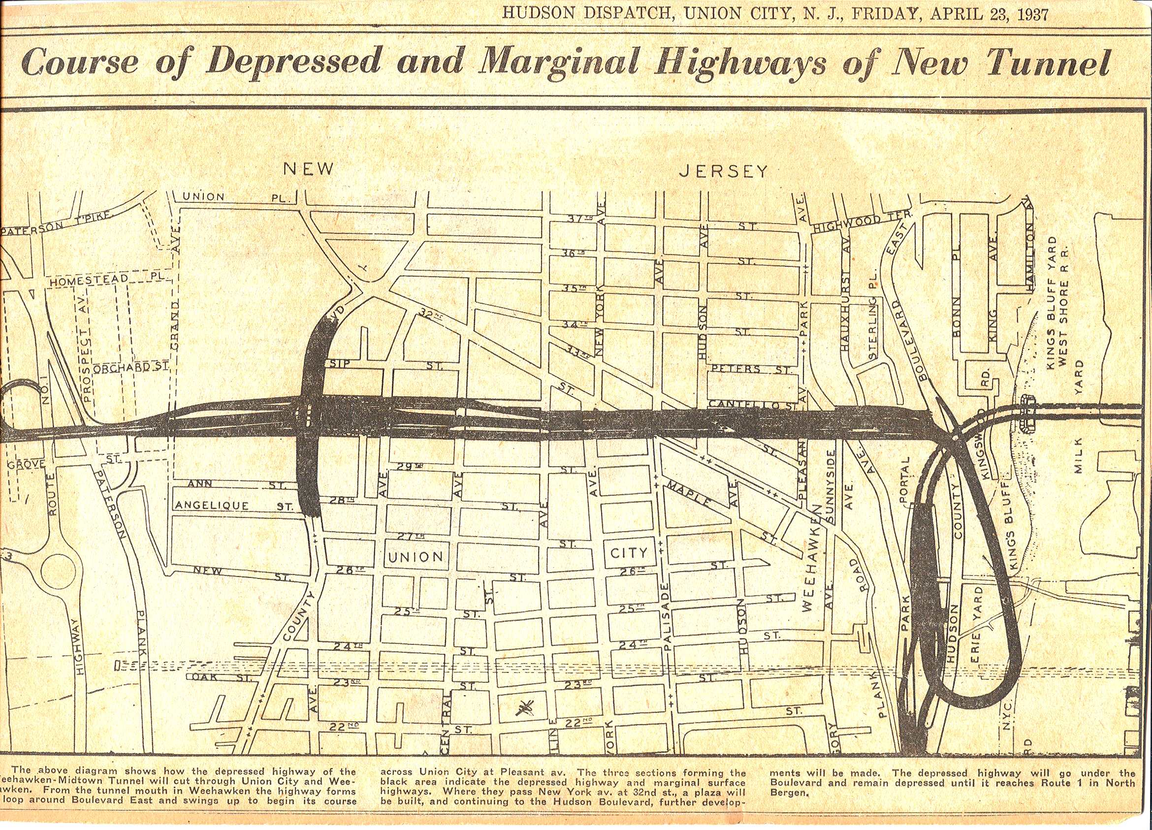
Map - Course of Depressed and Marginal Highways of New Tunnel
Item
- Title
- Map - Course of Depressed and Marginal Highways of New Tunnel
- Description
- Published in the Hudson Dispatch of Friday, April 23, 1937, this map shows the layout of the approaches to the new Lincoln Tunnel. Caption: The above diagram shows how the depressed highway of the Weehawken-Midtown Tunnel will cut through Union City and Weehawken. From the tunnel mouth in Weehawken the highway forms a loop around Boulevard East and swings up to begin its course across Union City at Pleasant av. The three sections forming the black area indicate the depressed highway and marginal surface highways. Where they pass New York av. at 32nd st., a plaza will be built, and continuing to the Hudson Boulevard, further developments will be made. The depressed highway will go under the Boulevard and remain depressed until it reaches Route 1 in North Bergen. This item is in the collection of the Weehawken Historical Commission.
- Subject
- WHC2005000004
- Date
- 1937
- Type
- OT
- Identifier
- WHC2005000004
- Coverage
- Lincoln Tunnel,Weehawken, NJ [40.7652034,-74.01610219999999]
- Tag
- Lincoln Tunnel
- Streets
- Transportation
- Rights
- This digital image may be used for educational or scholarly purposes without restriction. Commercial and other uses of the item are prohibited without prior written permission from the Weehawken Historical Commission.
Position: 255 (217 views)